Lower Michigan Miles 33.4 Total North Country Miles 33.4
Sunday, March 06, 2011
North Country Trail
Lower Michigan Miles 26.3 Total North Country Miles 26.3
Saturday, March 05, 2011
Roadwalk from the 36th and Segwun to Lowell Boy Scout Trailhead
Entering Lowell, MI from the South
Looking West down the Grand River
Looking East down the Grand River
Lowell Historical Museum
Looking North up Flat River
Robert E Lee paddleboat on Flat River
Downtown Lowell,MI
Lowell City Hall
Lower Michigan Miles 18.9 Total North Country Miles 18.9
Roadwalk to start
Saturday, February 26, 2011
Road walk from 92nd and Wingeier to 32nd and Segwun, Kent County,MI
Starting point at 60th and Segwun
Wingeier farm on Wingeier Road, not to far from Wingeier airfield!
George Krebs farm, Alto Michigan
Looking South on Segwun towards 60th
Looking West down I-94 towards Grand Rapids
Ending point at 36th and Segwun
Lower Michigan Miles 14.6 Total North Country Miles 14.6
Roadwalk to start
Roadwalk back to start
Saturday, February 19, 2011
Short 1.5 Mile Road walk from 100th and Baker to 92nd and Wingeier Rd.
Kent County,MI
7.4 Lower Michigan Miles 7.4 Total North Country Miles
Walk to Start
This walk started at the Johnson Road Kiosk in Middleville State Game area. Followed a gravel road north until it turned into a 2 track. Then continued north on Harris Creek Road to 108th St 2 track.
Beginning of walk at Johnson Road Trail Kiosk, Middleville State Game Area.
Looking North up Johnson Rd.
End of Johnson gravel road an beginning of 2 track.
Creek running under 2 track. Creek was over flowing bridge about shoelace hign.
2 Track
Lower Michigan Miles 5.9 Total North Country Miles 5.9
Return Walk
Sunday, February 06, 2011
North Country Trail This was an easy road walk from Morse Lake Rd and 108th st. 108th is the border between Kent and Barry Counties. Only 3.5 miles long. This was where I began at 108th and Morse Lake Rd.
This is a look up 108th. This is a one mile stretch that is primarily a 2 track. Mainly use in the winter by snowmobiles.
The Red sign here is indicating the Caledonia Sportsmans Club on the 2 track. Could hear gunfire coming from here during the entire walk.
Half mile after leaving the 2 track you Pass the GR Audobon Sanctuary.
Looking East down the Coldwater River, off Baker St. Grounds on the north bank maintained by Trout Unlimited.
Ending point at 100th and Baker.
Lower Michigan Miles 3.5 Total North Country Miles 3.5
Map of Return Walk
Saturday, June 19, 2010
Bike rid on White Pine Trail Big Rapids to Reed City
Saturday, June 12, 2010
Rode bike from Morley to Stanwood on White Pine Trail
Monday, May 31, 2010
Rode bike from Howard City to Morley on White Pine Trail.
Saturday, May 29, 2010
Bike ride on the White Pine
Wednesday, October 11, 2006
No running today. Just before Labor Day, I went on a sailing trip with my Dad and my brother in law Jeff. We sailed from Charlevoix to Beaver Island on Jeffs 27 foot Island Packet. The trip is about 40 miles each way. From Charlevoix to Beaver Island, I did most of the driving. Me and Dana Jeffs Dog taken it easy.


 From Charlevoix to Beaver Island, I did most of the driving.
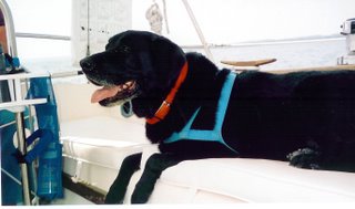
 Me and Dana Jeffs Dog taken it easy.
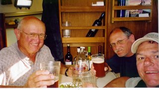 Celebrating a safe crossing!


 Dad with Beaver Island in background.
